Modeling Flood Risk in Samarinda: An Integrated Approach to Urban Resilience
For decades, people in Samarinda have learned to live with floods. They knew when the Mahakam River was likely to rise, and they would get ready by moving their belongings to higher ground or waiting it out on their elevated porches. It was a tough but familiar part of life.
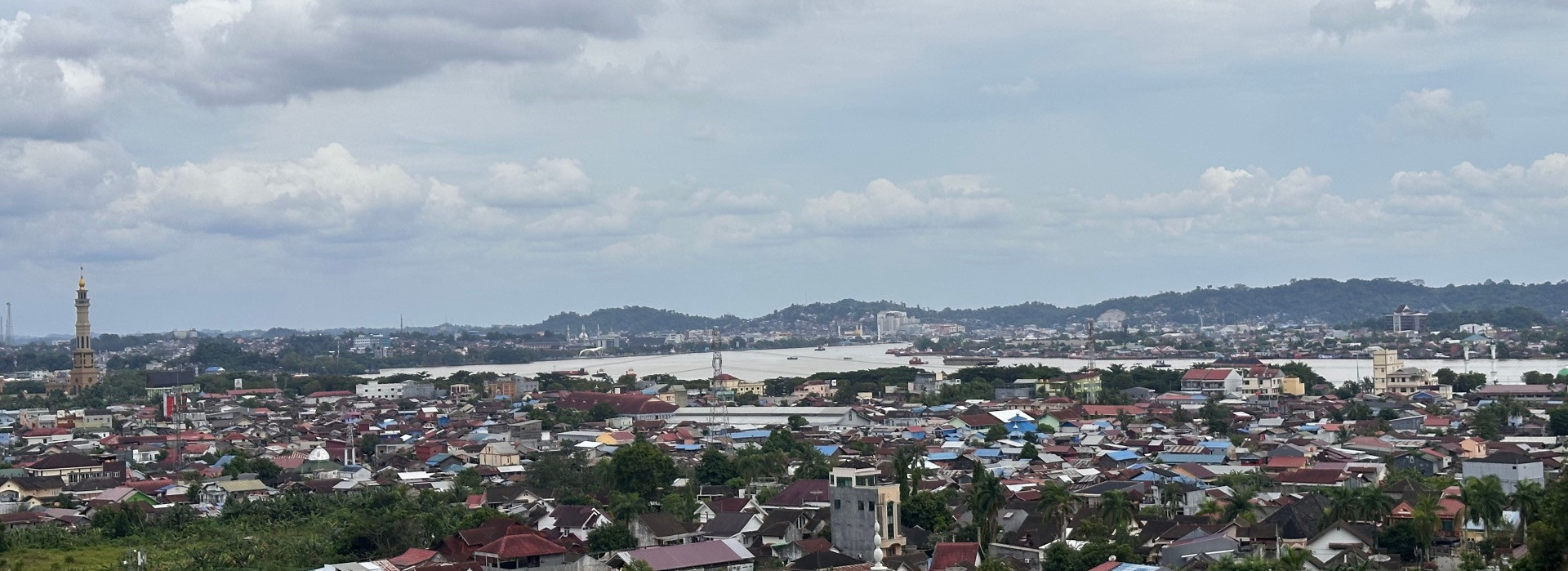
But something has changed. Now, the water comes faster, stays longer, and costs more than ever before. Even a short, heavy rain can bring knee- or waist-deep water into homes and businesses. Samarinda is a city of over 850,000 people, and a lot of it, over 60%, is low-lying and naturally prone to flooding. What used to be a predictable, seasonal event has now become a more dangerous, constant threat.
In the past forty years, Samarinda has flooded at least forty-five times, with some floodwaters reaching as high as a two-story building. The human impact has been huge: over fifty-three thousand homes have been affected, and major floods in recent years have forced thousands of families to leave their homes. The 2019 flood alone cost around forty billion rupiah (about $2.5 million USD), but that figure doesn't even count the lost work hours, missed school days, or medical bills that families have to pay long after the water goes away.
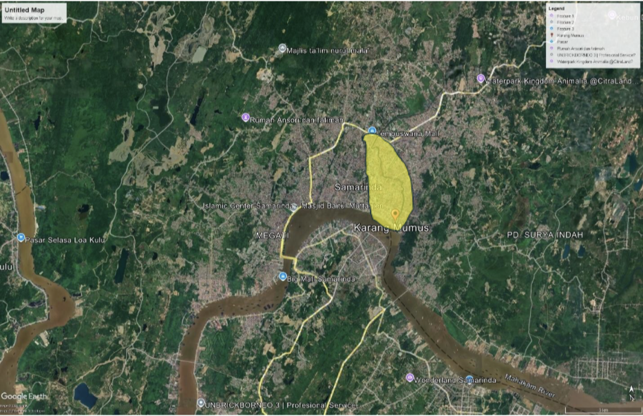
Photo: Neighbourhoods susceptible to flooding, confluence of Mahakam and Karang Mumus rivers (Image Source: Google Earth Pro )
Samarinda's worsening floods are primarily caused by changes to the natural environment both within and outside the city's boundaries. The rapid change in environmental landscape has caused the ground is less able to absorb water than it used to be. The city has paved over natural wetlands and green spaces that once soaked up stormwater. Plus, homes built right along the Karang Mumus River have squeezed the channel, making it harder for the river to flow and raising the flood risk for everyone. These changes, along with a shifting climate, are making floods more common, more severe, and less predictable.
Every flood brings a wave of costs that hits everyone. The city government has to spend money to fix roads and bridges. Businesses have to shut down for days or even weeks, which means they lose money. At home, families must pay for repairs and replace belongings that are ruined. Workers lose wages, and parents have to pay for doctor visits and medicine for flood-related illnesses. The city's government gets hit twice: they collect less tax money because of the floods, but they have to spend more on emergency response, leaving less for important projects like new schools or infrastructure.
As a port city, what happens in Samarinda affects more than just its residents. When floods block major transport routes, it causes delays in shipping and raises costs, which creates problems for businesses and people far beyond East Kalimantan. The financial damage from floods isn't just a single event; it adds up over time, with each flood chipping away at the financial security of families and the stability of the entire city.
The FINCAPES project takes a multifaceted approach to understanding Samarinda’s flood challenges, beginning with a focus on the scientific data. The work centers on the two main rivers that cause flooding: the Mahakam and the Karang Mumus through data collection on the shape of riverbeds and the surrounding land. This includes building a comprehensive model of the entire river system, encompassing areas outside the city. This approach recognizes that floods are influenced by more than just local rainfall; they are also shaped by land use and runoff from the broader upstream basin.
Beyond the scientific modeling, the project is working directly with the people of Samarinda, engaging women, low-income families, and other vulnerable communities to understand how floods affect their daily lives. By incorporating these lived experiences, the models are ensured to be socio-economically representative, moving beyond abstract data. This framework allows for a detailed examination of key variables, such as vulnerability to income and asset loss, the different impacts on various demographic groups, and the effectiveness of community support systems and local resilience strategies.
The project's flood risk study began with a foundational baseline survey across ten districts in Samarinda. This initial study gathered qualitative input from a broad range of stakeholders, including representatives from local government, academia, NGOs, and community groups. This data was essential for establishing a preliminary understanding of the day-to-day realities and challenges of living with floods, capturing the diverse impacts on different communities and livelihoods. This crucial initial data provides a benchmark against which the project's future findings and interventions can be measured.
Ultimately, FINCAPES work in Samarinda is designed to make the costs of inaction tangible. By projecting future losses, in lives, homes, livelihoods, and city revenues, FINCAPES is supporting decision-makers see that investing in resilience is a long-term saving. The findings from this study will serve as the crucial foundation for developing a loss and damage actuarial calculation to allow the government to quantify flood risks with unprecedented accuracy, paving the way for data-driven policies and financial strategies that will help the city manage future flood events more effectively.