FINCAPES Supports Evidence-Based Flood Risk Governance for a More Resilient Pontianak City, West Kalimantan, Indonesia
PONTIANAK — The Flood Impacts, Carbon Pricing, and Ecosystem Sustainability (FINCAPES) Project is advancing flood risk governance in Pontianak City, West Kalimantan, Indonesia, by combining scientific flood modelling, community-based public awareness, and actuarial analysis to strengthen evidence-based flood risk management and climate resilience.
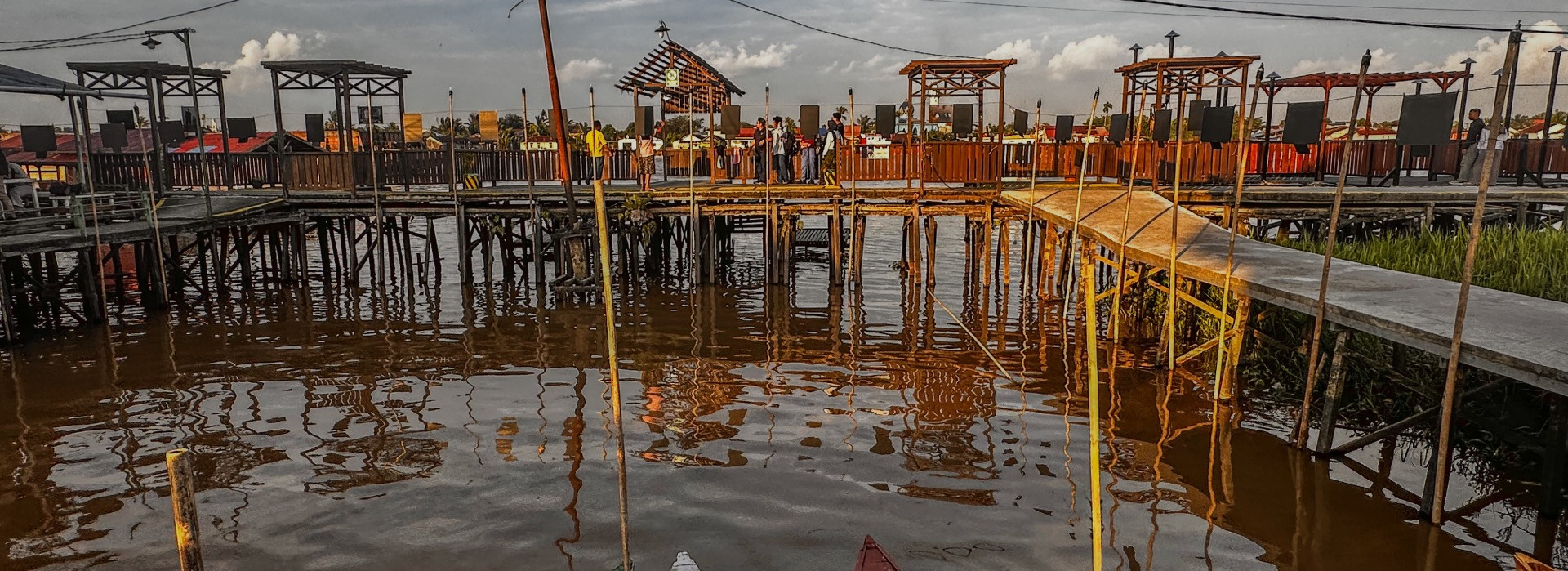
Pontianak, a low-lying coastal city influenced by tidal dynamics, heavy rainfall, and land subsidence, continues to face increasing flood risks. In January alone, several areas experienced tidal flooding up to twice, with water levels reaching nearly two meters.
“Pontianak is located in a relatively low-lying area, and several neighbourhoods are highly vulnerable to tidal flooding,” said Edi Rusdi Kamtono, Mayor of Pontianak during the Kick Off Meeting to Launch the Actuary Study (15/01). “In some areas along the Kapuas River, seawater regularly enters residents’ homes, causing material damage and, in some cases, forcing people to evacuate. Although the water may recede, flooding often returns the next day and can last for four to five consecutive days,” he added.
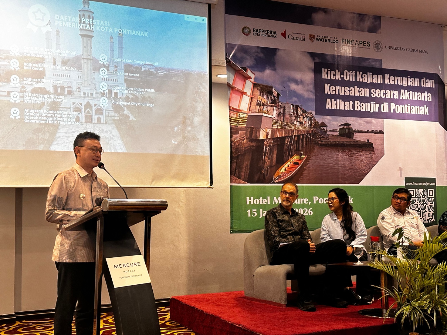
Caption: The Mayor of Pontianak City officially opened the Kick-Off Meeting and Technical Guidance Training for Actuarial Study to Calculate the Loss and Damage from Floods in Pontianak City (15 January 2026)
From Flood Hazard Mapping to Financial Risk Analysis
Between 2024 and 2025, FINCAPES supported a comprehensive flood risk study in Pontianak City, developing flood hazard scenarios and maps to better understand future flood frequency, depth, and duration under changing climate conditions. The study was conducted by the Tsunami and Disaster Mitigation Research Center (TDMRC), Syiah Kuala University Indonesia, and the final report has been formally handed over to City Government of Pontianak to serve as evidence for city planning and policy development.
Building on this foundation, FINCAPES formally launched an actuarial study on flood-related loss and damage through a Kick-Off Meeting and Technical Guidance Training held on 15–16 January 2025. The actuarial study aims to quantify financial losses from flooding under both current and future climate scenarios, generating evidence to inform policy development, risk financing strategies, and long-term urban resilience planning.
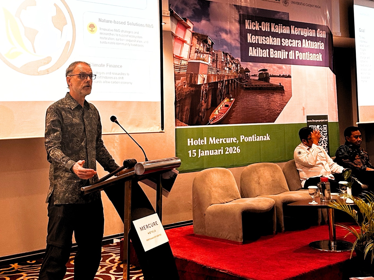
Caption: Prof. Stefan Steiner from Department of Statistics and Actuarial Science, University of Waterloo, who is also Principal Investigator of the University of Waterloo FINCAPES Project, presented the support of FINCAPES Project in strengthening flood risk governance in Pontianak City through a phased flood risk program that integrates flood hazard analysis, public risk communication, and an ongoing actuarial loss and damage study to support evidence-based flood risk governance.
From Flood Hazard Mapping to Financial Risk Analysis
According to Prof. Stefan Steiner, Principal Investigator of the FINCAPES Project, the study is designed to move beyond understanding where floods occur toward understanding what floods cost. “Flood hazard maps tell us about exposure, but they do not quantify losses,” he explained. “The actuarial analysis allows us to translate flood risk into measurable financial impacts that are critical for policy decisions, budgeting, and long-term resilience planning.”
The actuarial study is led by the Actuarial Research Group, the Department of Mathematics, Faculty of Mathematics and Natural Sciences, Gadjah Mada University Indonesia, with support from the University of Waterloo. It uses internationally recognized catastrophe modelling methods to estimate losses across multiple flood return periods and climate scenarios, producing key metrics such as Average Annual Loss (AAL). The study is being implemented from January to June 2026 and will conclude with stakeholder presentations and a dissemination workshop.
A central feature of the actuarial analysis is the integration of Gender Equality and Socio-Economic Inclusion (GESEI), ensuring that flood losses are assessed not only in physical and economic terms, but also in terms of differential impacts across gender, age, ability, and household structure.
“Flooding in Pontianak occurs relatively frequently, even when water depths are not always extreme,” said Danang Teguh Qoyyimi, Research Team Lead from Gadjah Mada University. “These events have direct social and economic impacts. When the potential for financial loss is significant, preparedness cannot wait until after a disaster occurs.”
Strengthening Public Awareness Through Community Voices
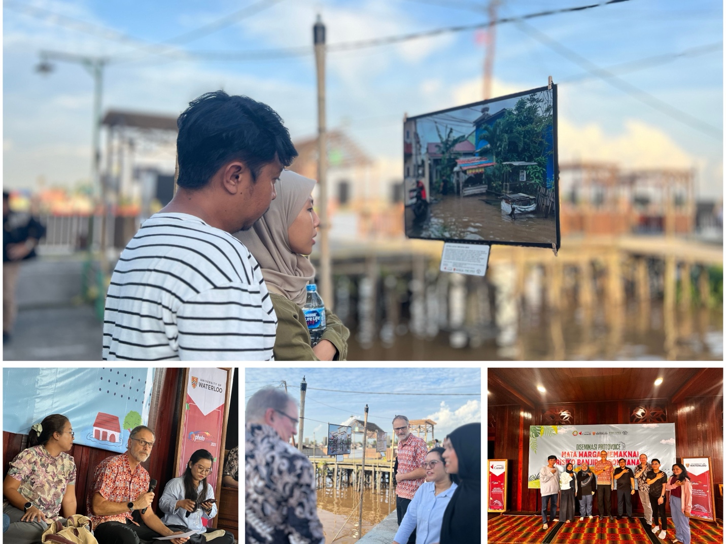
Caption: Photovoice initiative and series of community engagement activities were also conducted by FINCAPES to complement the flood risk modelling and actuarial calculation studies. Through this approach, public awareness is positioned not as a final output, but as a living process that strengthens collective understanding, encourages sustained engagement, and supports more inclusive and responsive flood risk governance in Pontianak City.
Alongside technical studies, FINCAPES has prioritized public awareness and inclusive risk communication as a continuous process to support flood risk governance in Pontianak City. This community-based communication serves as a way to spark sustained dialogue, learning, and participation in how flood risks are understood and addressed over time.
In 2025, FINCAPES partnered with Yayasan Kolase to initiate a Photovoice program, engaging residents from flood-prone areas to document their lived experiences of flooding through photography and storytelling. The Photovoice dissemination event, titled “Through the Eyes of Residents: Understanding Flood Risk in Pontianak,” was held on 15–16 January 2026 at Rumah Budaya Kampung Wisata Caping. The event featured community reflections, a public exhibition of 34 citizen photographs, and podcast publications, and was attended by local government representatives, academics, civil society organizations, and community members.
Importantly, the dissemination was designed as a platform for continued public engagement. Through Yayasan Kolase, the initiative brought together community actors and civil society organizations that have long worked on environmental and social issues at the neighbourhood level, including Kreasi Sungai Putat and Gantari Nawasena Society. These groups participated in radio podcast discussions, using the Photovoice outputs to reflect on everyday flood realities in the communities they have supported, and to connect scientific flood risk information with local knowledge, advocacy, and action.
“This initiative places residents as active subjects, not objects of research,” said Andi Fahrizal, Chair of Yayasan Kolase. “The photographs and narratives capture how floods affect daily life, livelihoods, and safety, while opening space for ongoing conversations about how communities and institutions can respond together.”
Prof. Stefan Steiner, in his remarks, emphasized that community perspectives are essential complements to scientific data. “Models and maps are important, but they do not tell the whole story”, he said. “Flood risk is experienced in homes, narrow alleys, schools, and small businesses. By translating scientific findings into human experience, these conversations help ensure that flood risk governance remains grounded in the realities people face every day.”
A Connected Approach to Flood Risk Governance
Together, the flood hazard study, public awareness initiatives, and actuarial analysis represent FINCAPES’ integrated approach to flood risk governance in Pontianak, linking science, community knowledge, and policy-relevant financial analysis. The FINCAPES Project is jointly implemented by the University of Waterloo’s Faculty of Mathematics and Faculty of Environment, with funding support from Global Affairs Canada, and reflects the broader Indonesia–Canada collaboration on climate resilience, disaster risk reduction, and sustainable development.